'Falcon' gains strength, accelerates over Philippine Sea
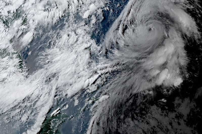
MANILA, Philippines — Severe Tropical Storm Falcon (international name: Khanun) intensified as it accelerated over the Philippine Sea Sunday afternoon, state weather bureau PAGASA said.
Falcon’s peak winds and gusts increased to 110 kilometers per hour near the center and up to 135 kph, respectively.
Moving north at 20 kph, the country’s sixth cyclone this year was last seen 1,170 kilometers east of extreme Northern Luzon.
Falcon is threatening more floods and landslides as areas battered by Typhoon Egay (international name: Doksuri) were still reeling from its impacts. Egay and the southwest monsoon left at least one million people affected and 16 dead.
What to expect
Falcon continues to enhance the southwest monsoon, which will bring occasional or monsoon rain to the western portions of Luzon and Visayas in the next three days.
The state weather bureau warned that floods and landslides may occur in areas that are highly susceptible to these hazards and in areas that received heavy rainfall recently.
The hosting of wind signals due to Falcon remains unlikely, according to PAGASA. But the enhanced southwest monsoon will bring gusty conditions in the following areas today:
- Zambales
- Bataan
- Pampanga
- Bulacan
- Metro Manila
- Occidental Mindoro
- Palawan
- Romblon
- Northern Samar
- most of CALABARZON
- Bicol Region
- Western Visayas
By Monday, residents of the following areas will experience gusty conditions:
- Ilocos Norte
- Pangasinan
- Zambales
- Bataan
- Pampanga
- Bulacan
- Metro Manila
- Occidental Mindoro
- Palawan
- Romblon
- Northern Samar
- most of CALABARZON
- Bicol Region
- Western Visayas.
Weather forecasters warned that sea travel along the western seaboard of Luzon is risky for small seacrafts.
Falcon is forecast to steadily intensify within the next three days and it may become a typhoon between late Sunday and early Monday, PAGASA said.
The cyclone may exit the Philippine Area of Responsibility Monday evening or early Tuesday.
Forecast positions
- July 31, 2023, 2:00 a.m. - 1,035 km east of extreme Northern Luzon
- July 31, 2023, 2:00 p.m. - 930 km east northeast of Extreme Northern Luzon
- August 1, 2023, 2:00 a.m. - 820 km northeast of extreme Northern Luzon (outside PAR)
- August 1, 2023, 2:00 p.m. - 765 km northeast of Itbayat, Batanes (outside PAR)
- August 2, 2023, 2:00 a.m. - 735 km north northeast of Itbayat, Batanes (outside PAR)
- August 2, 2023, 2:00 p.m. - 760 km north of Itbayat, Batanes (outside PAR)
— Gaea Katreena Cabico


- Latest
- Trending