'Egay' exits PAR; Another cyclone seen to threaten Philippines
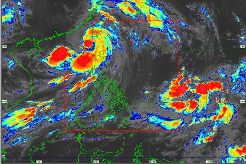
MANILA, Philippines — Typhoon Egay (international name: Doksuri) left the Philippine area of responsibility Thursday morning after battering northern Luzon with strong winds and heavy rain.
As Egay heads to Taiwan, a new tropical depression outside PAR is threatening to affect the country in the next few days, state weather bureau PAGASA said.
Egay was last spotted 255 kilometers west of Itbayat in Batanes, with peak winds of 150 kph near the center and gusts of up to 185 kph.
Wind signals were still raised in parts of northern and central Luzon due to Egay.
Signal No. 2
- Batanes
- northwestern portion of Cagayan (Claveria, Santa Praxedes) including Babuyan Islands
- northern portion of Ilocos Norte (Pagudpud, Adams, Bangui, Dumalneg, Burgos)
Signal No. 1
- Pangasinan
- La Union
- Ilocos Sur
- rest of Ilocos Norte
- rest of Cagayan
- Apayao
- Kalinga
- Mountain Province
- Ifugao
- Abra
- Benguet
- Isabela
- Quirino
- Nueva Vizcaya
- northern portion of Aurora (Casiguran, Dinalungan, Dilasag)
- northern portion of Nueva Ecija (Cuyapo, Guimba, Pantabangan, Science City of Muñoz, Carranglan, San Jose City, Lupao, Nampicuan, Talugtug)
- northern portion of Tarlac (Paniqui, Moncada, Pura, Camiling, Ramos, San Manuel, Anao, San Clemente)
Heavy rain, gusts
Even outside PAR, Egay continues to stir rain in Ilocos Norte, Ilocos Sur, La Union, Batanes, and Babuyan Islands. PAGASA warned of floods and landslides in these areas.
The cyclone also enhances the southwest monsoon, which will bring rain to western portions of central and southern Luzon in the next three days and gusty conditions in parts of Luzon and Western Visayas that are not under any wind signal.
The National Disaster Risk Reduction and Management Council reported on Thursday that at least five people were reportedly killed and over 26,000 people were displaced after Egay lashed the northern parts of the country.
State weather forecasters are also monitoring a tropical depression east of Eastern Visayas. It will be called “Falcon” once it enters PAR.
PAGASA weather specialist Chris Perez said the cyclone may enter PAR on Saturday evening or Sunday morning.
Forecast positions
- July 27, 2023 8:00 p.m. - 335 km west northwest of Itbayat, Batanes (outside PAR)
- July 28, 2023 8:00 a.m. - 540 km northwest of Itbayat, Batanes (outside PAR)
- July 28, 2023 8:00 p.m. - 815 km northwest of extreme Northern Luzon (outside PAR)
- July 29, 2023 8:00 a.m. - 1,150 km north northwest of extreme Northern Luzon or in the vicinity of Anhui, China (outside PAR)


- Latest
- Trending